


Authored article
Advantages of Geographic Information Systems in Healthcare
Advantages of Geographic Information Systems in Healthcare
![]() By Elets News Network - 20 May 2019
By Elets News Network - 20 May 2019


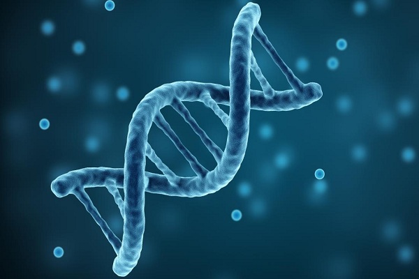
Technology is considered to be the driving force behind improvements in healthcare. Back in the 1800s, John Snow, the epidemiologist who pioneered work in tracking the source of a cholera outbreak, provided the classic example of how mapping can be used in epidemiological research. He identified the water source responsible for an outbreak of cholera in London by mapping the locations of those affected. Geographic information in healthcare analysis has continued to be used in public health for tracking child immunizations, conducting health policy research, and establishing service areas.
Geographic Information Systems is a computer-based tool that analyzes stores, manipulates and visualizes geographic information, usually on a map. In its most basic use, GIS answers the questions such as “Where are people living?” “Where are diseases starting?” and “Where are the sources?” for example. Researchers can easily use GIS to answer these questions and in many cases it can provide answers to other questions related to public health because maps created via GIS can help to show patterns between things such as disease starting points, risk factors and its sources.
Here are few examples of the potential benefits of integrating geographic information systems in healthcare:
Identifying the Health Trends:

GIS gives healthcare professionals the capability to perceive health trends and take targeted actions primarily based upon those results. One example of this action comes from tracking cancer outbreaks in California and finding evidence of increased prostate cancer levels in communities adjacent to crops heavily sprayed with pesticides. The application assesses the demographic data, such as home address, workplace, cancer type, and even information from wearable fitness tech of all patients entered into the system. Data is then georeferenced and mapped. Healthcare specialists can visualize the locations of patients and decide if there are clusters of type of cancers associated with similar working conditions or residential areas. With the number of non-communicable diseases such as cancer, diabetes, and cardiovascular disease rapidly rising, GIS provides a way to healthcare professionals to systematically address where certain diseases are more likely to be prevalent and can begin implementing preventative strategies in staffing health care professionals.

Tracking the Spread of Infectious Disease:
GIS systems not only monitordiseasebut also effectively use geography and other important inputs to identify where diseases are most likely to spread next. Data such as this can be indispensable to on the ground personnel working to save lives because it enables them to prepare in advance for a disease and can severely limit the impact. For instance, GIS based maps can help in analyzing the spread of infectious diseases like the flu and measles to better understand the spread of the disease. Maps can play a significant role in the management of disease outbreaks.In US, GIS systems were used to better understand the vaccination rates as to which locations could be the hardest to reach given a serious outbreak.
GIS in Wearable Tech:
Location-enabled devices are a lifesaver for people suffering from memory loss or disorientation, particularly dementias like Alzheimer’s or Parkinson, and autism. Using GPS tracking, wearable allow seniors to be found quickly and safely. GIS has the potential to discover long-term geographic trends in the health of certain demographics of people or individuals living within certain regions.
Improving Health Care Services:
The use of GIS technology know-how can enable community leaders and healthcare workers to work more closely with hospitals and to take larger steps in addressing country wide healthcare needs. For example,to understand if a certain population segment is receiving limited care because of their location, such as the Veteran’s Affairs Office, used GIS to understand the gaps in the service by mapping the distribution of veterans alongside the distribution of veteran service offices and health care facilities. The maps highlighted a number of areas where veterans had to travel significant distances to receive treatment. As a result 20 new Mobile Veteran Care Stations were lobbied across the US.
GIS in Indian Healthcare:
The Danida-assisted National Leprosy Eradication Program (DANLEP) is one of the foremost organizations to deploy GIS in the health sector in India. The DANLEP mapped the drug delivery points to patient location for the entire state of Madhya Pradesh. The Health GIS developed by DANLEP is being extensively used by other health sector programs, like TB control, HIV/AIDS, Maintaining Cold Chain equipment for Pulse Polio, etc. The government health system needs a technical management support to cater to the rural poor in improving the health service delivery.GIS can help in achieving excellence in transportation as well.The major areas of applications include highway maintenance, traffic modeling, accident analysis, and route planning. In many countries authorities actively use GIS for highways and transport management, especially with the increase in affordable, portable, and reliable devices. Ministry of Road Transport and Highways, India, has mandated recording of accident site latitude/longitude as India accounts for about 10% of road crash fatalities worldwide. The most important capability of GIS is that provides an evidence-based approach to accident management, emergency response strategy, facility distribution, and risk zone identification, which are efficient in traffic and road accident management.
Health care is a highly dynamic field. The data is continually updated and the analytics need to reflect that. GIS can provide us with the tools for mapping, visualizing, and analyzing the data across time. It is a powerful technology that has been efficiently applied to help address a wide variety of healthcare issues from disease management to healthcare service delivery. As more and more healthcare professionals and researchers adopt and integrate GIS into their work the benefits are likely to rise. GIS can be used by the government to help improve transparency, identify at-risk communities, and be used to help manage critical resources. There is a plethora of GIS data available for public health applications but most of it deals with sensitive information hence privacy and confidentiality of individuals is a large concern among researchers. As a result precautions must be taken while creating maps so that individuals are not identified based on the spatial data.
(Disclaimer: Writer is Chandrakiran Dubey, PhD Scholar, Indian Institute of Public Health Hyderabad. Views expressed are a personal opinion.)

 Like
1
Like
1
 Dislike
Be a part of Elets Collaborative Initiatives. Join Us for Upcoming Events and explore business opportunities. Like us on Facebook , connect with us on LinkedIn and follow us on Twitter , Instagram.
"Exciting news! Elets technomedia is now on WhatsApp Channels Subscribe today by clicking the link and stay updated with the latest insights!" Click here!